Listed 100 sub titles with search on: Main pages for wider area of: "WEST GREECE Region GREECE" .
AGIOS DIMITRIOS (Village) AMALIADA
Tel: +30 26220 41455
AGIOS ILIAS (Village) AMALIADA
Tel: +30 26220 94596
AGIOS KONSTANTINOS (Village) EGIALIA
Tel: +30 26910 71934
AGIOS VASSILIOS (Village) ACHAIA
Tel: +30 2610 992642
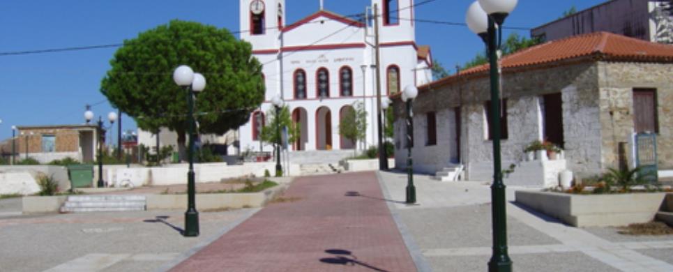
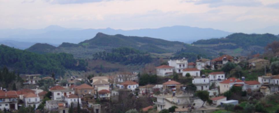
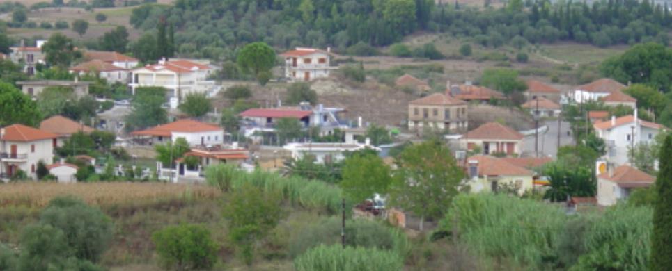
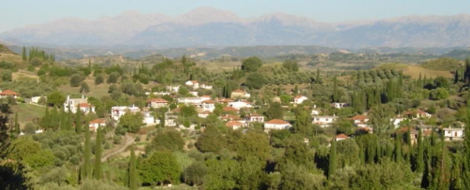
AKRATA (Small town) ACHAIA
The beautiful town of Akrata, built on the coastline and offering
azure blue seawater views, wonderful beaches, and modern tourist services, will
deeply affect those who desire to combine relaxation and adventure during their
holidays.
Akrata, as well as the picturesque beaches of the surrounding villages
of Trapeza, Platanos,
and Egira attract a large
number of vacationers during the summer months.
The remains of Ancient
Egira, the famous ancient theatre, as well as traces of the ancient
city of Aeges, which was destroyed around 281 B.C.
The post-Byzantine Monastery
of Agia Triada is built in the suburbs of Akrata, a lovely and hospitable
place. About 20 kms. away from the town the visitor meets Seliana,
where traces of ancient Felloi
mentioned by Pausanias in "Ahaika" have been discovered. The post-Byzantine
Monastery of Agioi
Apostoloi and the State Game Sanctuary belong to Perithori,
about 4 kms. southern of Seliana.
Rahova, close
to Perithori, is the place
where the "Greek School", one of the first ones established in Greece
after liberation from the Turks, operated from 1829 to 1837. This is the place
where many historical personalities of the 1821 Revolution, as well as distinguished
clergymen, such as the Patriarchs of Jerusalem Dositheos and Chrysanthos, were
acclaimed.
The mountainous areas southern of Akrata are of particular tourist
interest, as they offer o delightful view over the Limni tou Tsivlou
and the other scenic and historically important Kloukinokhoria (villages), such
as Agridi, Messorouggi,
Peristera, Solos,
Zarouchla etc. These villages
scattered in dense fir forests, keep the folk tradition vivid and alive.
The Byzantine church of Panagia stands in Zarouchla,
whereas on the slopes of Khelmos
the visitor finds the popular Spring of Golfo taken from Sryros Perisiadis’
play under the same name. Peresiadis’ mansion still stands in Messorouggi
where the church of Agios Georgios with the wooden hand carved temple is located.
Argyriadis’ tower in Agia
Varvara and the house of chieftain Theocharopoulos compose two of the most
significant historical points of reference to the mountainous cluster of villages
known as Kloukinohoria.
After a three-hour walk past Solos
village one reaches the mythically eternal Waters of the Styx, by which, in
Greek mythology, the Gods of Olympus
swore solemnly. Thetis is said to have bathed her son Achilles in the Waters of
the Styx and thereafter he became invulnerable. The visitor can walk from Styx
direct to Mega Spileo crossing
through the wonderfully steep slopes of Khelmos.
This text (extract) is cited March 2004 from the Prefecture
of Achaia tourist pamphlet (1999).

AMBELOKAMBOS (Village) AMALIADA
Tel: +30 26220 61215
ANO DIAKOPTO (Village) DIAKOPTO
Tel: +30 26910 97249
ANO KASTRITSI (Village) RIO
Tel: +30 2610 936140
ANTIRIO (Village) NAFPAKTOS
Antirrion the ancient Greeks called it "Rion the Malykreion",
and Rion "Rion the Achaikon". Here, on a hill, there lie ruins of two
anient cities, Makyneia and
Molykreas. Its geographical
site, at the entrance of the Corinthian
bay, made its fortification imperative. After the fall of Nafpaktos (29th
August 1499) Vagiazet the 2nd built there a fortress, that was seized in 1532
by A. Ntoria, chief of the united Christian forces. The fortress was rebuilt by
Morozini in 1669, but was demolished by the treaty of Karlovits and rebuilt again
later by the Turks.
The distance separating Antirion from Rion
is 1850 meters, soon to be connected by a giant bridge in light of the beginning
of 21st century.
This text (extract) is cited August 2003 from the Prefecture
of Aetoloacarnania tourist pamphlet (2000).
ARAVONITSA (Village) PATRA
Tel: +30 26910 94575
BASSAE (Ancient sanctuary) ILIA
The Temple of Epicurean Apollo
The temple of Apollo Epikourios stands at a height of 1130m on Mount Kotilio, 14km south of Andritsaina. At this site, which was called Bassai (little valleys) in antiquity, the inhabitants of nearby Phigaleia founded a sanctuary of Apollo Bassitas in the 7th c. BC, where they worshipped the god with the epithet Epikourios - supporter in war or illness. The temple of Apollo in the sanctuary at Bassai is one of the best-preserved monuments of the ancient Classical world. It was built from 420 to 400 BC on the site of an earlier, Archaic temple. The traveller Pausanias, who visited and admired the monument about the middle of the 2nd c. AD, states that its architect was Iktinos.
DAFNIOTISSA (Village) AMALIADA
Tel: +30 26220 94070
DIMITROPOULO (Village) EGIALIA
Tel: +30 26910 72043
DOUKANEIKA (Village) EGIALIA
Tel: +30 26910 94588
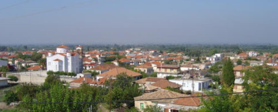
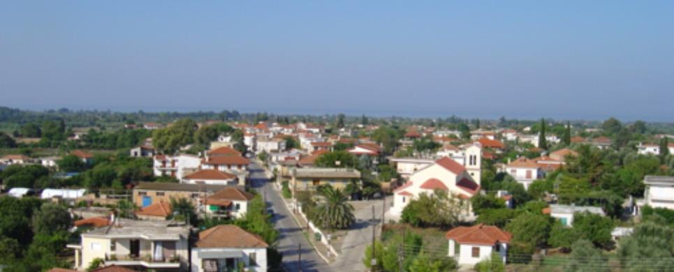
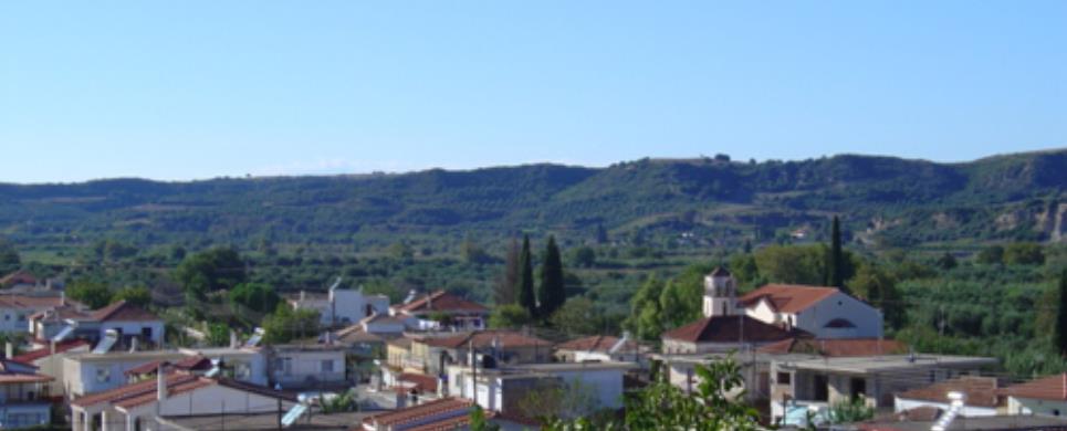
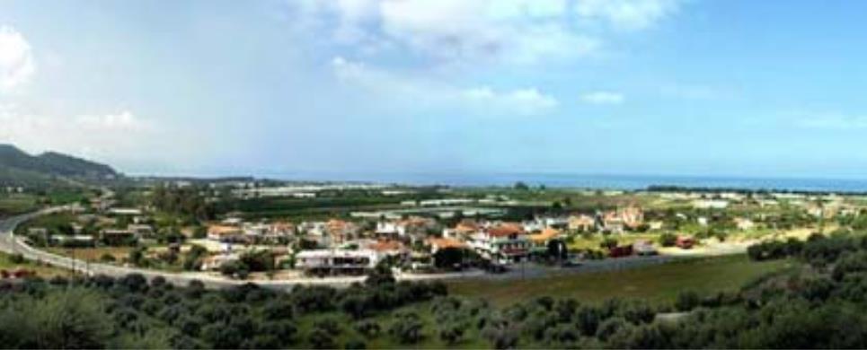
EGHIO (Town) ACHAIA
Aegio is the second largest city of Achaia.
It is built amphitheatrically on the western coast of the Bay
of Corinth. It is a commercial and industrial place and it has been referred
to as one of the most significant exporting ports of raisins and citrus ever since
1340 A.D.
Aegio, the capital of the province of Aegialia,
has known long periods of flourishing becoming the starting point of historical
events of definitive importance. Going back to prehistoric times it is referred
to as the capital of the Achaean Confederation. It is assumed that the Achaeans
set off from there for their expedition to Troy.
The famous church of Panagia Trypiti is located on the waterfront,
whereas the Monastery of Taxiarckhes
is very close to Aegio. Historical and artistic treasures of immense importance
are kept in the Museum of the Monastery. Across the valley on the right bank of
the River Selinous is built
the Convent of Pepelenitsa,
erected in the 15th century.
Beautiful neoclassical buildings impress a distinguished view of the
city on the visitor. Some of these are rare works of art constructed to the design
of Ernst Ziller (the Holy Metropolis of Aegio, the Palaia Agora etc.). In Psila
Alonia, the central square of Aegio, a tourist will not only enjoy a panoramic
view over the azure blue water of the Bay
of Corinth and the shoreline of Sterea
Ellas across the other side, but one will experience the vigorous pace of
a live city that does not forget its tradition. Ancient
Helike was founded eastern of Aegio. It was an important religious and cultural
centre in antiquity, sunk in the Bay
of Corinth in 373 B.C.
Fteri (set in
an altitude of 1150 m. against the backdrop of the unique beauty of a popular
fir forest), Loggos, Selianitika,
Lambiri, and other coastal
villages with exceptional beaches and cosmopolitan atmosphere, are all located
within a short distance from Aegio.
The famous cogwheel train starting from Diakopto,
east of Aegio, terminates in Kalavryta
following the spectacular canyon of the River
Vouraikos.
At this point continues E4, the European Trail of Long Distances,
one of the most important walking courses in Europe, which can be covered any
time throughout the year, thanks to the mild climate of the area.
This text (extract) is cited March 2004 from the Prefecture
of Achaia tourist pamphlet (1999).
EGIRA (Ancient city) ACHAIA
Ancient Aigeira was one of the most important towns of Achaia and
the Achaiko Confederation. It was located east of the present day community of
Aigeira, on the hill "Paliokastro", has an altitude of 650m and the
main settlement was fortified with strong walls.
Ancient Aigeira, which existed before the period of Homer has been
of concern to many writers who seemed to locate it between Sikionos and Aigiou.
Polivios referring to the location of Aigeira writes, "the town of Aigeira
is located between Aigio and Sikionos and is built in fortresses and impassable
hills, and looks towards Parnasso".
According to Alzinger, the first people settled there in 3 thousand
B.C, namely in the early Greek period. Evidence of their existence, are the fragments
of ceramics found in the excavations of the lower stratum. During the period of
Homer it was known as Iperisi and this was, the name referred to by Homer on the
list of ships that took part along with other Achaian towns in the Trojan expedition.
The name Iperisi, and according to Pausania Ipirisia, was maintained in Ancient
Aigeira for many centuries and according to the archeologist Otto Walter until
the 23rd Olympiad in 688 B.C.
As referred to by Pausania, Iperisia got its name Aigeira when it
was, inhabited by the Iones and they were, invaded by the Sikionioi. So as the
residents could defend themselves effectively and because there were few of them,
they gathered all the goats (aiges) in the area and lit torches which had been
placed in their horns and they let them loose against the Sikionion, who were
so frightened that they left. Therefore, the Iperisies were, saved by the goats
(aiges) and they changed the name of their town to Aigeira. There are those however
who claim that Ancient Aigeira got its name from a type of Poplar-tree, the aigeirous,
which was abundant in the area during ancient time. A third version as to the
origin of the name of Ancient Aigeira is that referred to by Nikolaos Papandreadis
in his book, "History and Folklore of Zaholis". He claims that it got
its name from a nobleman from Patra, named Aigeiro, who took over and ruled it,
therefore giving it his name.
Ancient Aigeira lived great periods of prosperity and was at its peak.
Due to the excellent location that it occupied on the east section of Aigialeias,
north of Mount Evrostina, it was visible not only by the neighboring towns of
Corinthos but also from across the sea, of Central Greece, towns of Aitolon. It
therefore suffered from many hostile invasions, the most familiar being that of
the Aitolon in 220 or 219 B.C and that of the Sikionion. As a result of their
victory against the Sikionion, they built the holy sanctuary of Agroteras Artemidos,
as they believed that the fabrication (with the goats already mentioned) against
the invaders was inspired by Artemis.
In Ancient Aigeira, according to descriptions of Pausania, there was
a statue of Zeus made of marble from Pendeli, a statue of Athina, temple of Artemidos,
with ancient statues of Agamemnona and Ifigeneias, statues of "Asklipiou"
of Serapidos and Isidos and a holy sanctuary dedicated to Apollon.
Coins of Ancient Aigeira
From the catalogue of coins of the monetary collection of Copenhagen,
it appears that approximately in the year 330 B.C, Aigeira cut copper coins with
Athina on the front side and on the other side, the front end of a goat inside
an olive wreath. They also cut coins with the head of a woman wearing a veil,
which on the front side there is the inscription ?Aigiaraton? and on the back,
a goat with a wreath. Also, in the years 193-221 A.D with the head and shoulders
of Plautillas, wife of the Roman emperor Karakala.
Olympic champions of Aigeira
Ancient Aigeira was distinguished for its many significant Olympic
champions. The most familiar of these were Kratinos the Aigeiratis and Ikaros.
Kratinos was a very significant wrestler and won the Olympic children?s wrestling
contest. Ikaros won the race of 1 stadium in the 23rd Olympiad.
The decline of Ancient Aigeira
The town of Aigeira must have been at its peak until the 4th century
A.D. We reach this conclusion from a decree by the Roman emperor Dioklitianou,
who determined the prices of different provisions which are bought by the Roman
soldiers so as to avoid exploitation by the merchants of that period. The decree
was written on marble plaques that were found in the excavations of Ancient Aigeira
and,believed to have been written in 303 A.D. It is claimed that it was destroyed
by a strong tidal wave, although it is considered more likely to have been destroyed
by a powerful earthquake.
The findings of the excavations in the area os Ancient Aigeira
The first excavations in the area of Ancient Aigeira began in 1916
by the Austrian Archeological Institute, which still continues its excavations.
The archeological findings of the investigations of the excavations
to this day cover a period of time from 3000 B.C, to the Imperial years of Rome
and almost to the 4th century A.D. From the first days, the investigation which,
was carried out by Otto Walter was crowned with amazing success. On the 31st of
August 1916, the head of the marble statue of Zeus was found. According to Pausania
the statue was the work of the famous creator Evklidi from Athens, and the height
exceeded three metres. In subsequent investigations the left arm and one finger
of the right hand of the same statue were found.
O. Walter's second stirring discovery was that of the "Pillar"
of the theatre of Ancient Aigeira. According to Wilhem Alzinger who continued
the investigation from 1972 onwards, the theatre was constructed during the 5th
towards the 4th century B.C.
The front part of the stage of the theatre was decorated with semi-pillars.
Still preserved is the orchestral drain and the north wall of the stage with a
central door which during the Roman years was transformed into venetian style.
The greater part of this evidence of the theatre was destroyed during the 2nd
century A.D, when the stage was transformed. With this transformation a three-storey
stage was created, where its architectural decor shows little evidence of relics.
The facade was divided into three storeys with a protective roof.
The lower was of Doric style, the middle was Ionic and the upper was Corinthian.
The building of the three-storey stage is dated back to the years of Andrianou,
117-138 A.D.
At the location of the excavations there has also been found a part
of the wall of the town, a kiln for pots and pot fragments from 3000 B.C, marble
plaques on which is written the decree of the Roman emperor Dioklitianou, many
inscriptions and names. At the excavations of 1972, on the north side of the theatre
a part of the temple of Zeus was discovered as is believed by Alzinger. The floor
is covered with splendid mosaic and river pebbles, and is decorated with different
pictures such as vultures, beetles and an eagle attacking a snake and two vases.
From 1989 to this day, the excavations and investigation are carried
out by Antonio Faber, architect and professor at the University of Vienna, professor
O. Mous and the students of the university.
This text is cited June 2004 from the Municipality of Aigeira URL below, which contains images
ETOLIKO (Town) IERA POLIS MESSOLONGIOU
Tel: +30 26320 22530
Fax: +30 26320 26320, 23324
GIANNITSOCHORI (Village) ZACHARO
Tel: +30 26250 61483
ILIS (Ancient city) ILIA
The city-state of Elis developed in the northwest Peloponnese, far
away from the major urban centres of the rest of Greece, and played only a limited
role in the military and political events of the ancient Hellenic world. Neverthless,
it remained centre-stage for hundreds of years, as quardian of the panhellenic
Sanctuary of Olympia, responsible
for the irreproachable preparation and organization of the Olympic Games.
Evidence from excavations to date shows that Elis was settled, albeit
as a small farming village, from the Early Helladic period (c.2800-2000 BC). In
Mycenaean times (c. 1600-1100 BC) it was one of the four most important town in
the region and its ingabitants, who are referred to as Epeians
in the Iliad, took part in the Trojan War under the leadership of Polyxenus.
The city of Elis was founded by Oxylus, who came from Aetolia
in the 12th century BC, with the socalled Descent of the Dorians, and united all
the scattered townships. Ancient tradition has nowadays been confirmed by the
rich finds of the Submycenaean, Protogeometric and Geometric periods (c. 1100-700
BC) recovered from the region.
Oxylus founded the Olympic Games when he incorporated the Sanctuary
of Olympia in the city-state of Elis. The games were reorganized in the 8th century
BC by his descendant King Iphitus, who signed a treaty with the kings Lycurgus
of Sparta and Cleisthenes
of Pisa. Under the terms
of the 'Sacred Truce' the entire region of Elis was declared sacred, thus guaranteeing
peace and the success of the games. In 776 BC, when the first Olympiad was held,
the Eleians assumed supervision of the Sanctuary of Olympia. They forfeited this
privilege to the Pisans in 668 BC but regained it, with the help of the Spartans
in 580 BC.
Henceforth the city enjoyed a great heyday, which lasted until the
end of the 5th century BC. Political and other public issues were of little interest
to Elis, whose chief concern was the organization of the Olympiads. The games
were quinquennial, that is they were held at the end of a four-year period,
most probably in mid-July. To comply with the rules, the competing athletes were
obliged to come to Elis for training one month before the games commenced. They
were accompanied by friends and relatives, resulting in the influx to the city
of choice foreigners from the mainland and islands of Greece, as well as from
the prosperous colonies in Asia Minor and Pontos, Magna Graecia and Africa.
The importance that the Eleians attached to the organization of the
Olympiads is reflected in the picture of the city's agora. The traveller Pausanias,
who visited Elis in the 2nd century AD, describes gymnasia, a palaestra, stoas,
temples, sanctuaries and temene (sacred precincts) but no building associated
with civic life. These edifices were adorned with a host of statues and sculptures
by famous artists fo antiquity. Pausanias mentions, among other monuments, the
temple of Aphrodite Urania (Heavenly), with its chryselephantine statue of the
goddess, a work by Pheidias; the open-air temenos of Aphrodite Pandemos (of the
people), which housed a renowned bronze statue of the goddess, a work by Scopas;
the temple and statue of Apollo Acesius (Healer); the temple of the Graces with
the acrolithic statues of them; the temple of Silenus and the sculptural group
of the god with Methe (Drunkeness).
At its zenith the Eleian state comprised four districts: Coele (Hollow)
Elis - the fertile plain where the capital of the Eleians developed -, Acroreia,
Pisatis and Triphylia.
The people lived in an atmosphere of peace, prosperity and lawfulness. The rich
soil of the region and the mild climate favoured the development of agriculture
and animal husbandry. Indeed he names Elis and Eleians (ancient Falis and
Faleioi) denote the valley and the valley-dwellers respectively.
In recent years excavations have revealed 120 settlements, while surveys
have located another 200 or so sites. Most of these were probably small villages
or isolated farmsteads. Only the capital, Elis, developed into a thriving urban
centre. After the establishment of the democratic body politic and its second
synoecism in particular (471 BC), it was reinforced considerably and became one
of the largest and most populous cities in the Peloponnese. It occupied the area
between the present villages of Paliopolis
(or Nea Elis) in the southeast, Bouchioti
(or Avgeion) in the southwest and Kalyvia
in the west. The ancient acropolis was on Ayannis hill.
Women played a significant role in the management of public affairs
in Elis. According o Pausanias, there was a council of sixteen wise Eleian women,
which had to its credit the reconcilation of Pisa and Elis, as well as the institution
of the Heraean Games. These were panhellenic foot races for girls, held in honour
of the goddess Hera and organized every four years, like the Olympics but on different
dates.
By the late 6th century BC Elis was minting its own coinage, which
during the period of its peak rivalled that of other Greek cities in art and execution.
There were also local pottery workshops and foundries for casting bronze statues,
whose products had a very distinctive character.
The flourishing of the Eleian state was largely due to its long-standing
alliance with Spata, which was dissolved during the Peloponnesian War (431-404
BC). In the 4th century BC the first signs of its imminent decline and the vicissitudes
of the Eleians appeared. In 191 BC they joined the Archaean Confederacy, while
in 146 BC they were subjugated by the Romas, becoming part of the Roman province
ar Achaea. During the period of Roman rule (27 BC - AD 250) the city of Elis expanded
even more. Villas and thermae, which were particularly popular among the Romans,
were built, some of them upon the ruins of Classical edifices.
In Late Roman and Early Christian times (3rd - 5th century AD) habitation
was confined to just one sector of the city, while in other part a large cemetary
was founded, perhaps after the destruction by the Herulians in AD 267. Decadence
came when the Emperor of Byzantium Theodosius I banned the Olympic Games, in AD
393, and life in the Sanctuary of Olympia ceased. The earthquake that struck the
region in the 6th century AD dealt the final blow to the Eleian state.
Xeni Arapoyanni, ed.
Translation by: Alexandra Doumas
Cited Sep 2002, from the Municipality of Amaliada information pamphlet
Xeni Arapoyanni, ed.
Translation by: Alexandra Doumas
This text is cited Sep 2002
, from the information pamphlet of
Amaliada Municipality
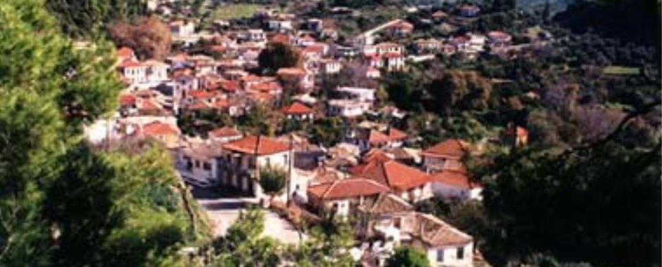
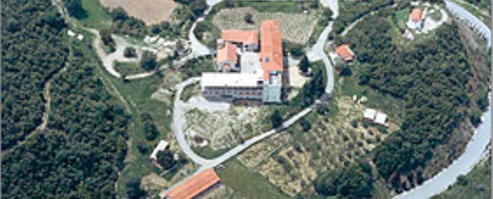
KALAVRYTA (Small town) ACHAIA
Kalavryta, the capital of the province
of Kalavryta, is a town that actually belongs to all Greeks, despite the fact
that geographically it belongs to Achaia.
It is the city-symbol of freedom.
The Greek Revolution against Turkish domination started in Kalavryta
in 1821. The Banner of the 1821 Revolution is kept at the historical Monastery
of Agia Lavra. The Holy Monastery
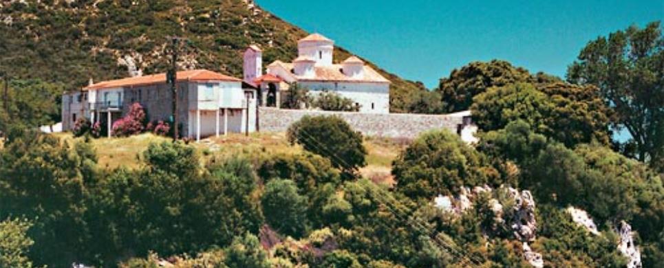
of Mega Spileo, the most amazing shrine of the Eastern Orthodox Church in
Peloponnesus, lies not far
from Kalavryta. The Monastery, built 924 m. above the sea level in 326 A.D. has
been destroyed four times. Nonetheless, the Holy Icon of Theotokos, which according
to the tradition is ascribed to Luke the Evangelist, has always been saved.
During World War II Kalavryta became a target of the German occupation
forces. In 1943 all the male population of the town was executed by the Germans
who in turn burnt all the houses and churches. A huge cross stands as a memorial
of the massacre of Kalavryta on a hill above the tormented town.
In our days Kalavryta is a picturesque town that serves as a starting
point in touring the surrounding areas. The cogwheel train coming from Diakopto
terminates at this point.
At Kalavryta Ski
Centre winter sports fan are offered one of the best ski runs in Greece,
whereas the wonderful Spileo
ton Limnon, a rare work of nature, is only situated 17 kms away from the town.
This is the only cave in the world where ponds are layered on three separate levels.
The visitor of the Kalavryta Metropolitan area is given the opportunity
to admire historical and archeological sites as Ancient
Loussi, Pausania’s vine-branch, the ancient
town of Klitoras, the Castle of Oria, the Chelonospilia, as well as places
of extraordinary natural beauty as the springs of the rivers Ladonas
and Aroanios.
All around Kalavryta, scattered on the slopes of Chelmos
and Erymanthos, there are
75 villages, most of them built in forests of pine and plane trees.
Dafni and Klitoria
are two of the most picturesque small towns of Achaia
with cultural and commercial activities but even natural beauties.
The whole province
of Kalavryta - from Tripotama
to Livardzi and up to the
town of Kalavryta - with its abruptly changing landscape, its idyllic spots, the
characteristic architectural style, and the developing tourist structure constitutes
an area that will attract even the most demanding of the visitors.
This text (extract) is cited March 2004 from the Prefecture
of Achaia tourist pamphlet (1999).
KALAVRYTA (Ski centre) ACHAIA
Kalavrita ski resort is situated on the North West side of mountain Helmos
at an altitude of 1,700 meters (base) to 2,340 meters (summit).
It has been operating since 1988 and consists of:
It is located 14 kilometers from Kalavrita
and only 203 Kilometers from Athens.
The ski centre is open daily throughout the ski season (December to April) from
09:00 to 16:00.
This text has been cited in February 2005 from the following webpage of Kalavryta Ski Centre.
KATO ACHAIA (Small town) PATRA
Western Achaia is one of the most beautiful parts of the Greek land.
The visitor will be stunned by the sudden scenery changes, the exquisite sandy
beaches, as well as the popular resorts on the slopes of Erymanthos
and Panahaikos.
Kato Achaia is the most important commercial and intellectual centre
of the area. According to historians, in antiquity this must have been the territory
of the city of Dyme, a member
of the Achaean Confederation. Its residents had participated in all national contests
and they had developed a remarkable civilization while keeping the name of Achaia,
which, according to Homer, was the first name of Greece.
Araxos airport,
which is the only place in Achaia
where an airplane can land on is not far from Kato Achaia. Metohi
with a wonderful Museum of Natural History is also nearby.
The golden beach of Kalogria,
an endless sandy beach with sky blue water and an exotic atmosphere, together
with the pine forest of Strofylia, composes and idyllic landscape famous all round
Europe.
Pappas pond and the wetland of Prokopou consist a rare ecosystem of
unique beauty and great scientific interest. It is here where Teichos Dymaeon,
as well as many archaeological ruins, lie.
Along the coastal strip starting southwest of Patras
and extending down to the western border of the Prefecture we meet on the waterfront
many scenic villages with significant tourist services. Such villages are Vrahnaika,
Kato Alissos, Niforeika,
Lakopetra, Alikes,
a fishermen’s village and a Commune of the Municipality
of Kato Achaia is not far form there either.
In the interior of Western Achaia, in the area of Chalandritsa,
the excavations of 1928 brought into light burial grounds of the Mycenaean era.
Similar remains were discovered in the Community of Portes
in 1995.
Katarrachtis,
Demesticha, and Leontio
(where the ruins of an ancient
city and a theatre of the 4th B.C. century are exposed) are three of the most
picturesque villages in the area, and so is Michas,
which is set 1,100 m. above sea level. The whole are is situated right on the
site of ancient Tritaea,
offers very good tourist services, as well as an amazing view. The surrounding
area of Fares is equally remarkable
for its traditional communes and the obvious traces back to the time of Frankish
rule. In Skiada the ancient
Tower of a Byzantine general, Doxapatri, has escaped destruction, whereas further
south lie the scanty ruins of the castle of Paleologos. Sandameri
is the favourite area of parachutists who organize games of perpendicular and
vertical free-falling.
Last but not least, the monasterial cluster of Movri
foothills (Agios Nikolaos Spata,
Batha, Maritsa, and Filokali), which attract a large number of visitors, also
belong to Western Achaia.
This text (extract) is cited March 2004 from the Prefecture
of Achaia tourist pamphlet (1999).
LAKKA (Village) SYMBOLITIA
MONI AGIAS ELEOUSSIS (Monastery) PATRA
Tel: +30 2610 998343
MONI AGIAS MARINAS MARITSIS (Monastery) PATRA
Tel: +30 26930 91374
MONI AGION THEODORON (Monastery) KALAVRYTA
Tel: +30 26920 33244
MONI AGIOU IOANOU THEOLOGOU (Monastery) EGIALIA
Tel: +30 26910 94129
MONI AGIOU NIKOLAOU (Monastery) PATRA
MONI EVAGELISTRIAS (Monastery) KALAVRYTA
Tel: +30 26920 71215
MONI KOIMISSEOS THEOTOKOU NOTENON (Monastery) PATRA
Tel: +30 26940 91381
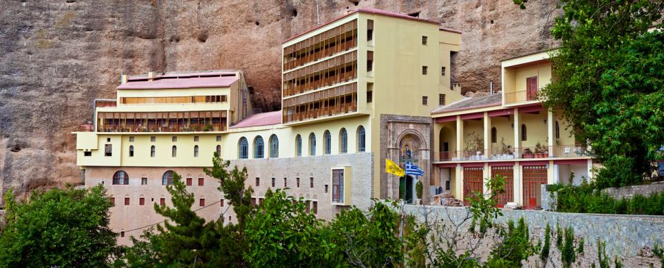
MONI MEGALOU SPILEOU (Monastery) KALAVRYTA
Tel: +30 26920 22401, 23130
Fax: +30 26920 23035
MONI PAMEGISTON TAXIARCHON (Monastery) EGIALIA
Tel: +30 26910 56515
MONI SKAFIDIAS (Monastery) ILIA
Tel: +30 26210 94273
MONI VLACHERNON (Monastery) ILIA
MYROVRYSSI (Village) EGIALIA
Tel: +30 26910 94167
NERANTZIES (Village) EGIALIA
Tel: +30 26910 72939
PALEROS (Ancient city) ETOLOAKARNANIA
The most important feature of the area is the ancient city of Paleros,
which was situated on the Northwest part of the peninsula in today’s Kechropoula
and constituted a nuclear cell to rest of the buildings, which were in the peninsula
and on opposite land. The city is considered to have existed during Mycenean period,
taking as a proof parts of the city’s walls which date back to 2000 B.C.
The construction of the walls interchanges between the square-shaped and the polygonal
system and as a whole is of different chronical periods.
The citadel on the eastern part of the yard is separated by a partition
and is considered that near it’s Southwest gate there is the most ancient
part of the wall which is of the Mycenean period.
The port of ancient Paleros was situated in the region of today’s
Pogonia in the Southwestern
part of the peninsula, where ruins of harbour facilities have been located in
the eastern part of the village at a distance of 2-3 km from the ancient Paleros.
There was also an ancient sanctuary at place "Profitis Ilias"
which consisted of a temple and a pavilion with pillars in perimetric order that
dates back to 5th or 6th century B.C.
This text (extract) is cited August 2003 from the Municipality
of Kekropia tourist pamphlet.
PATRA (Town) ACHAIA
Patras, the very ancient city of the mythical Patreus, is the third
largest city in Greece and the
capital of the Prefecture of Achaia.
It is a significant commercial and converging point. Its port constitutes the
western gateway to Greece. Millions
of visitors stop by and admire the exceptional street plan and architectural style
of the city.
The rich historical and cultural heritage of Patras, its significant
religious and archaeological monuments, the pace of a modern, live city that offers
many possibilities for entertainment set the city apart as an attraction pole
of thousands of visitors. In the course of Greek History, from prehistoric times
to our days, Patras has always played a pivotal role in the development and moulding
of historical conditions. Every corner of the city is its own historical reference
point.
The culmination of all the cultural events of the city, as well as
the major winter show of the country is the Carnival of Patras. It is an endless
feast lasting two months during which time the colours, gaiety, imagination, and
high-spiritedness carry away every single inhabitant of the city as they all join
in happiness and sorrow.
The International Festival attracts thousands of visitors every summer.
The biggest names in the Arts and Cultural life of the place honour the deeply
rooted cultural tradition of all the inhabitants of Patras.
The Municipal District Theatre of the city - one of the largest and
most active groups in Greece
- feature outstanding performances of the classics every season.
Sporting events are highly favoured in the city, which as two sizable
football grounds and three indoor Gymnasiums. Popular athletic events are held
in the National Stadium of Patras, whereas basketball, volleyball, and gymnastics
contests of European and International interest are organized and held in the
Palais De Sport. Moreover, there are three modern conference centres with space
available for the organization of commercial and trade exhibits.
Places worth visiting are the following: the Holy Church of Agios
Andreas; the Castle
of Patra; the Archaeological
Museum; the Municipal
Theatre ‘Apollo’ (designed by Ernst Ziller); the Holy Church of
Pantokrator (a Byzantine church); the Roman
Odeon (the most beautiful Roman edifice in the area); the Castle
of Rio built in 1499; the Yirokomio
Monastery; the Monastery
of Omblou; ACHAIA CLAUSS (where a visitor can be toured around the premises
of the wine making plant and have a taste of Mavrodaphni aroma); the Catholic
Church of Agios Andreas, and the Municipal
Gallery.
This text (extract) is cited March 2004 from the Prefecture
of Achaia tourist pamphlet (1999).
POROVITSA BEACH (Beach) AKRATA
PSATHOPYRGOS (Village) RIO
Tel: +30 2610 931541
SELIANITIKA (Village) EGIALIA
Tel: +30 26910 74273
SOLION (Ancient city) ETOLOAKARNANIA
In the middle of the peninsula of Plagia
in place of Sterna, there was a fortress which had optical control from the Northwest
region to the Southeast. The fortress had been constructed during the 5th century
and is considered to be identified with the city of "Sollion", which
was Corinthian colony. "Sollion" was conquered during Peloponnesian
war by the Athenians and according to Thoukidides (430 B.C.) is included in the
occupation of Palerians - Akarnanians.
"Sollion"is considered by many historians as a city in a
hostile Akarnanian land, where Paleros
and Alyzia dominated. The
nautical decline of Corinthos
rang the Knell of its existance therefore one can observe that Sollion was not
a city but a nautical Corinthian spot.
This text (extract) is cited August 2003 from the Municipality
of Kekropia tourist pamphlet.
VOULKARIA, LAKE (Lake) VONITSA
The lake Voulkaria or "Mirtountion" according to Stravon
stretches on the North side of the city (of Paleros).
This lake is probably the remnant of a lagoon covering the valey of Paleros during
the Homeric period. This lagoon is referred to have been a saver for the Queen
of Egypt, Kleopatra, as a
result of its shallowness. After Kleopatra’s defeat by the Romans in the
naval battle of Aktion in
the year 31 A.D. and chased by her enemies, she managed to cross with ease in
her light-built ships via the shallow canal of Paleros, while the heavily armed
Roman ships were obstructed by the bed of the canal. The name of the canal, the
"Mole of Kleopatra" has been kept as a memory ot the Queen’s crossing.
This text (extract) is cited August 2003 from the Municipality
of Kekropia tourist pamphlet.
ZACHARO (Small town) ILIA
Zacharo, the magic city that lies on the southwest coast of Ilia
Ionian Sea side. The visitor
can admire the natural beauty of the area and the longest sandy beach in Europe
with crystal clear water. Escaping into the deep blue of the sea promises to water
sports lovers (and not only them) the largest center of water sports in Peloponnisos.
The unique Kaiafa
lake with its thermal springs is included in the beautiful countryside. It
also provides world class water ski installations.
Archaeological sites, old fashioned villages with rare customs and
traditional museums and also intense night life are amongst the highlights of
municipality of Zacharo.
Visitors can address municipality’s tourist office for their
better service.
The text is cited March 2004 from the Municipality
of Zacharo tourist pamphlet.
ZACHLORITIKA (Village) DIAKOPTO
Tel: +30 26910 41646

Receive our daily Newsletter with all the latest updates on the Greek Travel industry.
Subscribe now!