Listed 18 sub titles with search on: Information about the place for wider area of: "IERAPETRA Town LASSITHI" .
AGIOS IOANNIS (Village) IERAPETRA
The municipality of Agios Ioannis covers the area east of the municipality
of Ierapetra, from the southern slope of the mountain "Thripti" or "Aori" as the
locals call it, to the coast and it is the easternmost part of the county of Ierapetra.
Most of the 1,069 permanent residents, live at the coastal villages and occupy
with farming and tourism. The municipality conisits of the villages:
Koutsounari, a coastal village of 437 inhabitants, 10.5 km east
of Ierapetra, is the seat of the municipality. At Koutsounari there is one of
the longest and prettiest beaches of Ierapetra, with all the tourist facilities.
Agios Ioannis, a small traditional village located at the slope
of the hill "Katalimata" 500m a.s.l. 17.7km away from Ierapetra, with 38 inhabitants.
Ferma, a village close to Koutsounari with 579 inhabitants, also
a popular tourist resort.
Agia Fotia a small settlement, located in a picturesque cove,
within a few distance from Ferma to the east. It has 15 permanent residents and
quite a few hotels and taverns.
Sights
The gorge of "Milonas" with small water falls, not easily accessible.
Many chapels of architectural and historical interrest.
Tourist facilities
There are a lot of hotels of all classes, bars, and taverns especially
at the beach of Koutsounari and Ferma. The place attracts a lot of visitors every
year due to the clear sea, awarded with the blue flag by the EEC.
This text is cited September 2004 from the Interkriti URL below.
ANATOLI (Village) IERAPETRA
The village of Anatoli is 10km northwest of Ierapetra and it contains
some remains of a Venetian fort as well, as of a Byzantine church.


DIKTI (Mountain) LASSITHI
The mountain range in the Lassithi prefecture is the Dikte. Its tallest
peak is Mount Dikte, 2,148 metres above sea level. On the north side of Mount
Dikte, in the Lassithi Plateau is the Dikteon Cave where legend says Zeus was
hidden from his father, Kronos. The Lassithi Plateau with its distinctive windmills
is surrounded by the peaks of Dikte and it lies at a height of 850 metres above
sea level.
This text is cited Feb 2003 from the Crete TOURnet URL below, which contains images.
EPISKOPI (Settlement) IERAPETRA
The village of Episkopi is 7km north from Ierapetra. There is an architecturally
interesting Byzantine church in Episkopi--the church of Agios Georgios, on the
east side of the village square. The new church of the Panagia has a doorway and
columns taken from an older Byzantine church. Behind the church there are some
marble remains of the older church. The church of the Panagia was a bishopric
church during the second Byzantine period. Tradition says that it was named the
Panagia of Seven Domes because of its seven domes.
This text is cited Feb 2003 from the Crete TOURnet URL below, which contains image.
IERAPETRA (Town) LASSITHI
Ierapetra, the largest city in southern Crete, is located at the narrowest
crossing of the island, and is easily reached from Agios Nikolaos. There are daily
buses from Iraklion, Agios Nikolaos, and Sitia to Ierapetra. There are local buses
to the villages west of Ierapetra.
Ierapetra has many hotels, rooms for rent and tavernas and the area around the
harbour has many restaurants. There are also tours by boat to the island of Gaidouronisi
(Donkey Island).
This extract is cited Feb 2003 from the Crete TOURnet URL below, which contains images.
KALAMAFKA (Village) IERAPETRA
The village of Kalamafka is 11km northwest of Ierapetra and 25km south
of Agios Nikolaos on the road Agios Nikolaos - Kalo Horio - Kalamafka. The village
of Kalamafka is impressively situated on the edge of a mountainside. From Kalamafka
you can see both coastlines (north and south Crete) and forested hills. The chapel
of the Panagia is located on the side of the west mountain above the village.
Kalamafka was probably the site of an ancient Greek city called Larissa which
was occupied by Ierapytna and its habitants forced to leave for Ierapytna. Later
some of them were allowed to return. In the hill of Kastellos there is a cave
and within it the church of Stavros, reached by an ascent of 242 steps, after
which one may enjoy the view from the top.
This text is cited Feb 2003 from the Crete TOURnet URL below, which contains images.
MESSELERI (Village) IERAPETRA
The village of Meseleri is north of Ierapetra, and is 20km south of
Agios Nikolaos on the road Agios Nikolaos - Kalo Horio - Meseleri. It is the site
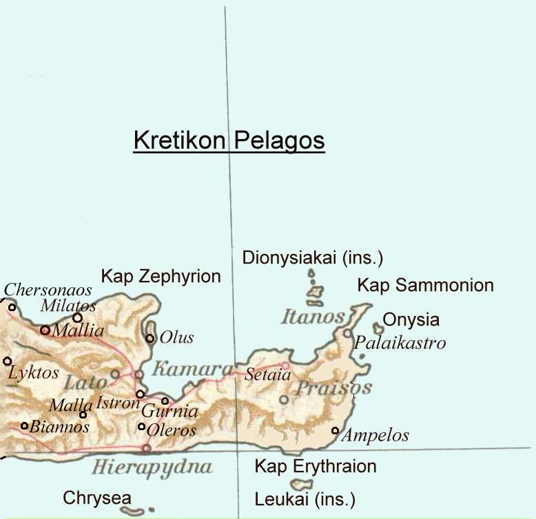
of the ancient city of Oleros.
NEES MALES (Village) IERAPETRA
The village of Males is located 40km southwest from Agios Nikolaos
on the road Agios Nikolaos - Kalo Horio - Anatoli - Males, and 22km northwest
of Ierapetra on the road Ierapetra - Ligia - Anatoli - Males.
It is the site of the ancient town of Malla. Malla was an independent town, and
an inscription discovered information about a treaty between Malla and Lyttos
in the third century B.C. During the Venetian occupation Males was the largest
village in Ierapetra province. The area near Males contains some interesting Byzantine
churches and monasteries.
This text is cited Feb 2003 from the Crete TOURnet URL below, which contains image.
DIKTI (Mountain) LASSITHI
Dicte (Dikte, Strab. x. p. 478 Diod. v. 70: Steph. B.; Dikton, Arat.
Phaen. 33; Diktaion oros, Etym. M. s. v.; Dictaeus M., Plin. iv. 12: Juktas),
the well-known Cretan mountain where; according to story, Zeus rested from his
labours on earth and in heaven. Here the lying Cretan dared to show the tomb of
the Father of gods and men, which remained an object of veneration or curiosity
from an early period to the age of Constantine. (Cic. de N. D. iii. 2. 1; Diod.
iii. 61; Lucian, de Sacrif. 10, vol. i. p. 634, de Jov. Tragoed. 45, vol. ii.
p. 693, ed. Hemst.; Origen. c. Cels. ii. 143, p. 475, ed. Par.) The stony slopes
of the mountain rose to the SE. of Cnossus, ou the E. side. Mr. Pashley found
considerable remains of ancient walls at about 100 paces from the summit. The
fragments offered good specimens of the polygonal construction. (Trav. vol. i.
p. 220.) These, no doubt, are the remains of that ancient city described by the
Venetian writer (Descrizione dell' Isola di Candia) as lying on the E. or opposite
side of the mountain to Lyctus, of which Ariosto (Orland. Fur. xx. 15) makes mention:
Fra cento alme citta ch‘ eano in Creta,
Dictea piu ricca, e piu piacevol era.
On the lower slopes was the fountain, on the wonders of which the
Venetian writer gives a glowing description (Mus. Class. Antiq. vol. ii. p. 270),
and which must, therefore, have existed at an earlier date than that recorded
by the inscription as given by Mr. Pashley (Trav. vol. i. p. 211.)
This text is from: Dictionary of Greek and Roman Geography (1854) (ed. William Smith, LLD). Cited September 2004 from The Perseus Project URL below, which contains interesting hyperlinks
IERAPYTNA (Ancient city) IERAPETRA
Hieraputna, Hiera Putna, Hiera Petra, Hierapudna, Hiera Pudns. A town
of Crete, of which Strabo says that it stood in the narrowest part of the island,
opposite Minoa. Hierapytna, according to the Coast-describer, was 180 stadia from
Biennus, which agrees with the distance of 20 M. P. assigned to it by the Peutinger
Table. It was a town of great antiquity, and its foundation was ascribed to the
Corybantes; it bore the successive names of Cyrba, Pytna, Camirus, and Hierapytna.
From an inscription preserved among the Oxford marbles, it appears that the Hierapytnians
were at one time allied with the neighbouring city of Priansus. Traces of this
city have been found at the Kastele of Hierapetra. There are both autonomous and
imperial coins belonging to Hierapytna; the symbol on the former is generally
a palm tree.
This text is from: Dictionary of Greek and Roman Geography (1854) (ed. William Smith, LLD). Cited June 2004 from The Perseus Project URL below, which contains interesting hyperlinks
OLEROS (Ancient city) IERAPETRA
Oleros, Eth. Olerios. A town of Crete, situated on a hill, with a
temple to Athene. In the struggle between Cnossus and Lyctus, the people of Olerus
sided with the latter. (Polyb. iv. 53, where the reading Orioi appears to be a
mistake.) In the Descrizione dell' Isola di Candia, A.D. 1538 (ap. Mus. Class.
Antiq. vol. ii. p. 271), the site is occupied by a place called Castel Messelerius.
This text is from: Dictionary of Greek and Roman Geography (1854) (ed. William Smith, LLD). Cited June 2004 from The Perseus Project URL below, which contains interesting hyperlinks
IERAPYTNA (Ancient city) IERAPETRA
OLEROS (Ancient city) IERAPETRA
IERAPYTNA (Ancient city) IERAPETRA
Hierapytna, later Hierapetra (Ierapetra) Greece. City on the S coast of Crete, on the S side of the narrow isthmus
which forms the shortest and easiest route across the island from the Gulf of
Mirabello on the N coast. There is little evidence of prehistoric habitation.
The city was a Doric Greek foundation, with probably a considerable Eteocretan
element. Almost nothing is known of its early history. It was supposedly founded
by Kyrbas; the name indicates a Rhodian link, as do two of its early names, Kyrba
and Kamiros (Steph. Byz.). It struck coins from the 4th c. on. Much of our knowledge
of its history is derived from inscriptions, mainly treaties showing its growing
influence in the 3d c., and its pro-Macedonian policy at the end of the century.
In the war of certain Cretan cities supported by Macedon against Rhodes and her
allies (204-201), the powerful Hierapytnian fleet, which was probably active in
piracy, attacked Kos and Kalymnos. After the war the city changed sides and made
a treaty with Rhodes (201-200), indicating that Rhodes needed her support in suppressing
piracy.
Between 145 and 140 Hierapytna expanded to the E, destroying the neighboring
city of Praisos, and occupied its territory, including the Temple of Dictaean
Zeus (at Palaikastro on the E coast). There followed a long boundary dispute and
hostilities against Itanos; despite Roman mediation these were not settled until
112-111. During Metellus' conquest of Crete (68-67) Hierapytna was the last city
to surrender (Dio 36.19. 1ff). That the town prospered in the Imperial period
is clear from the remains which once existed, the continuing inscriptions, and
Servius remark (on Aen. 3.106) that only Hierapytna and Knossos, of the 100 cities
of Crete, survived in his day. The latest inscription is a copy of Diocletian's
price edict (301). The city was later a bishop's see; it was destroyed by the
Saracens in 824 and probably rebuilt by them.
The main deities were Zeus, Hera, Athena (Polias and Oleria) and Apollo;
Egyptian cults also flourished.
Travelers in the 15th- 19th c. saw considerable remains: a 16th c.
visitor reported two theaters, an amphitheater, baths, and an aqueduct. Today
there are only a few remains of one theater and the amphitheater on the E side
of the town, and a few scattered traces of other buildings. A number of tombs
have been found in the necropoleis E and W of the city, but the city site has
not been excavated. The harbor was an impressive construction, with an inner and
an outer basin; the inner one is now marsh and the outer basin is mostly under
the modern town. The final form of the harbor, particularly the outer basin with
two curving moles of rubble and concrete, must date from the Imperial period.
The harbor gave the city importance, but the site was low-lying and difficult
to defend.
Larisa, Oleros, and Chryse island (now Gaidharonisi) were in the territory
of Hierapytna. The site of Larisa is not certain, but it lay inland to the N;
the likeliest candidates are Kedri, just N-NE, which has LM remains, and Kalamafka
to the NW, with remains of MM to Byzantine date. The people of Larisa were transferred
to Hierapytna in a synoecism. Oleros, probably to the N at Meseleri, E of Kalamafka,
had a temple of Athena Oleria. By the Hellenistic period it belonged to Hierapytna,
but it had once been independent, and perhaps had controlled the latter as its
port.
On the coast to the W, near the modern Myrtos, are remains, including
a Roman bath building, of a Graeco-Roman harbor town whose ancient name is not
known. It seems to have been within the territory of Hierapytna in the Hellenistic
period (see Myrtos).
D. J. Blackman, ed.
This text is from: The Princeton encyclopedia of classical sites,
Princeton University Press 1976. Cited Nov 2002 from
Perseus Project URL below, which contains 1 image(s), bibliography & interesting hyperlinks.

Receive our daily Newsletter with all the latest updates on the Greek Travel industry.
Subscribe now!

