Listed 100 (total found 156) sub titles with search on: Local governments for wider area of: "EVIA Island GREECE" .
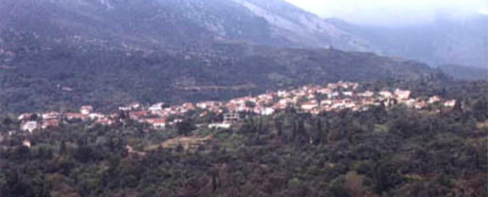
AMYGDALIA (Village) KARYSTIA
Tel: +30 22240 26213, 26413
Fax: +30 22240 25802
LICHADA (Village) ISTIEA
Tel: +30 22260 33298
Fax: +30 22260 33633, 33298
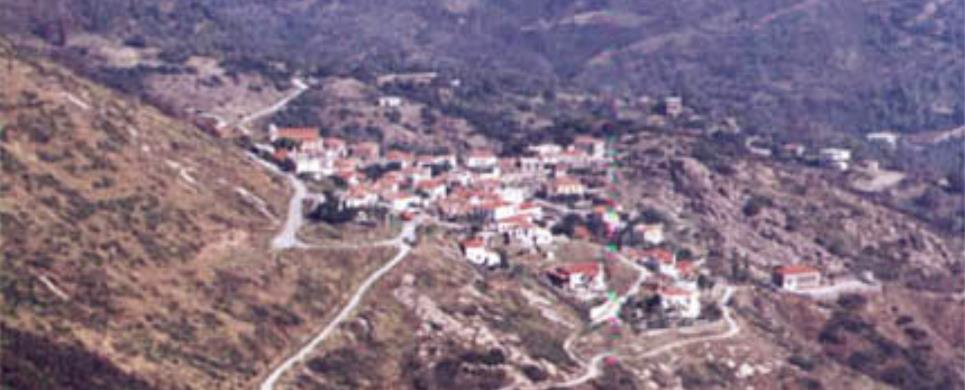
AGDINES (Village) ISTIEA
It is a village built in a thick forest of pine trees on a mountain.
The drive from the main cross-roads to the village is enjoyable even to the most
demanding visitor. Perennial plane trees, pine trees, flowing streams and the
Aegean Sea, which lies in
the background, leave the visitor speechless with astonishment. The region is
ideal for the fans of hiking.
Τhis text is cited May 2003 from the Municipality
of Artemissio tourist pamphlet.
AGIA SOFIA (Village) CHALKIDA
Tel: +30 22280 22142
AGIOS ATHANASSIOS (Village) DIRFYS
Tel: +30 22280 71011
AGIOS DIMITRIOS (Village) KARYSTIA
Tel: +30 22240 71201
AGIOS GEORGIOS (Village) KARYSTIA
Tel: +30 22230 31054
AGIOS IOANNIS (Village) ALIVERI
Tel: +30 22230 81473
AGIOS LOUKAS (Village) ALIVERI
Tel: +30 22230 81475
AGIOS NIKOLAOS (Village) CHALKIDA
Tel: +30 22210 52326
The picturesque beach of Bourtzi got its name from the large fortress, built by the Venetians and used also by the Turks to control the straits of the Southern Evian Gulf, so that pirates could pass to and from Chalkida. The beach is not as popular for swimming as are the taverns which will give you a taste of fresh Evian, fish.
AGIOS VLASSIOS (Village) KARYSTIA
Tel: +30 22220 58603
AGRIOVOTANO (Village) ISTIEA
According to tradition its name stems from the weeds ("agriovotana")
growing in the region. Even though it covers a small area, it offers a spectacular
view. From the small square of the village the visitor can discern the mountain
Pilio and, weather permitting, even Athos. A passable dirt road leads from the
village to the beach "Koutsoubri" where there are picturesque taverns. The beach
is ideal for windsurfing and jet-skiing. The luxuriant vegetation and the long
beach compose a unique colourful scenery.
Τhis text is cited May 2003 from the Municipality
of Artemissio tourist pamphlet.
ALMYROPOTAMOS (Village) EVIA
Tel: +30 22230 53012
Fax: +30 22230 53816
Almyropotamos is the most notherly village of the Municipality
of Styra, located close to the border with the Municipality
of Dystos in an area of great interest. It has 500 residents and is set in
a rocky hillside in front of the valley which spreads out from the Dipotamo river.
The coastal hamlet of Panagia
belongs administratively to Almyropotamos, as does the islet of Kavalliani.
Many commentators identify Kavalliani as the ancient Glaukonissos, in the soil
of which the Olympic winner Glaukos, son of Dimilos, was buried by his fellow
Karystians.
The palaeontological survey in the valley of Almyropotamos has uncovered
many important finds which belong to mammals of the so-called Picermius fauna.
These are mainly the remains of small-bodied horses which were no higher than
1.30 metres tall and had three toes on each foot. According to specialists, Picermius
fauna belongs to a steppe environment and has an Asian origin; it is dated to
around 13 million years ago.
This text is cited May 2003 from the Municipality
of Styra tourist pamphlet.
AMARYNTHOS (Small town) CHALKIDA
ANDRONIANI (Village) KYMI
Tel: +30 22220 31715

ANO KOUROUNI (Village) KARYSTIA
Tel: +30 22220 58969
ANO POTAMIA (Village) KYMI
Tel: +30 22220 71498
ANO VATHIA (Village) CHALKIDA
Tel: +30 22290 36680
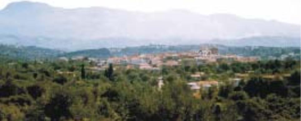
ARTEMISSIO (Village) ISTIEA
Artemissio is the main village in the Municipality of Artemissio.
The old name of the village was "Kourbatsi" (Turkish word which means thrashing).
In 1926 the village established a community independent of the Municipality of
Istiaia and was renamed Artemissio
in honour of the goddess Artemis whose temple was situated in the area of St.
George, where the cemetery of Pefki
is located today.
A tour of the village, where there are still houses dated from the
Turkish domination, is worthwhile. If you are fond of nature, you will enjoy walking
a little further from the village where there is a magnificent ravine full of
plane -, pine- and walnut-trees which will lead you to an area called "Agrilitsa".
The view is breathtaking, the eye can see as far as Mt Pelion
and the Sporades.
Τhis text is cited May 2003 from the Municipality
of Artemissio tourist pamphlet.
ASMINIO (Village) ISTIEA
Tel: +30 22260 41309
A modern village which maintains local colour. Its former name was
Potaki or Potoki (a word of Turkish origin) which means swampy area. It offers
comfortable accommodation and it is known for its nice ouzeris situated at the
central square. The village produces salted preserves of excellent quality.
It is worth visiting the church of Virgin Mary Dinious, 6km from the
village on the way to Istiaia, built in a magnificent landscape of plane trees
and flowing streams. The word "Dinious" is Turkish and means "return". According
to tradition, when a Turkish soldier fired the icon of Virgin Mary, the bullet
backfired and killed him. Her memory is celebrated on August 23 at a big fete
which attracts many natives as well as tourists.
Τhis text is cited May 2003 from the Municipality
of Artemissio tourist pamphlet.
AVLIDA BEACH (Small town) AVLIDA
Tel: +30 22210 31334
A coastal area in the South Evian Gulf with a 6km shore line. The waters are shallow and there are many taverns along the beach with local delicacies. The beach of Avlida is connected by coastal road to Dilesi, Chalkoutsi, Skala Oropou and, via Vathy, to the national highway Athens – Chalkida. Until 1927 the area was called Dramesi but since then it was recognized as the municipality of Avlida belonging to Evia Island, even though it is on the mainland. The story of the village starts in the prehistoric era, according to a few findings in the area. A local myth is that residents are decendents of Kadmos from Sparta. It was also a tourist resort in antiquity for the people of Thebes as it is now for the Athenians. In the 1991 census Paralia Avlidas had 2.473 residents but the population rises dramatically in the summer due to vacationers and can reach up to 15.000.Paralia Avlidas is a scenic place that has evolved into a resort with many vacation homes. Being close to Thebes that has an army training center, many of its residents are high ranking officers and the locals are mainly involved in agriculture and fishing.
EDIPSOS (Small town) EVIA
Edipsos did not suddenly spring up yesterday. It is, on the contrary,
steeped in history, with deep roots in the distant past. Tradition holds that
the Iones first settled here and named their new home "Ellopia" for Ellopos, the
son of Iona. It was later referred to as "Edepsos" in Aristotle's Meteorologica,
a toponym also inscribed on a stone found in Thessaly. Ploutarch described a very
pleasant stay in Edipsos with its lively social life and entertainment, praising
its fine cuisine of fish and fowl. Strabon wrote of the appearance of new springs
and their healing properties. From very early times Edipsos was, moreover famed
for its copper mines, perhaps one for the reasons it was one of the few towns
to mint its own coins. One of them appears as an illustration in Regas Fereo's
Charta. It bears the image of a crab on one side and a fish on the other, symbolizing
the abundant sea life of the area.
In Roman times Edipsos flourished due to its mineral waters and the
favour it found amongst the Roman elite. The emperors Hadrian, Septimus Severus
and Marcus Aurilius bathed in its waters. Other visitors included Gaius Pompeius,
Savinus, procosul of the Emperor Augustus and General Syllas. The best preserved
ruins from the Roman period are known as Sylla's Baths.
With the decline in Roman domination and the rise in Byzantium, Edipsos
was destroyed for being a center of paganism.
In more recent times, the cosmopolitan atmosphere of Edipsos drew
the attention of renowned politicians, artists, writers and jet-setters.
This text is cited May 2003 from the Municipality
of Edipsos tourist pamphlet (1999).
ELLINIKA (Village) ISTIEA
The village is located on a slope of a hill covered with pine trees.
Its name has derived from the Greek ("ellinika") ships which anchored at the beach
before the naval battle of Artemissio.
Its beautiful beach is a real jewel, a harbour for small boats, with
pine trees along the sea. Across the beach there is a small island with the church
of St. Nikolaos. Swimming to the island is an opportunity to enjoy a workout.
Τhis text is cited May 2003 from the Municipality
of Artemissio tourist pamphlet.
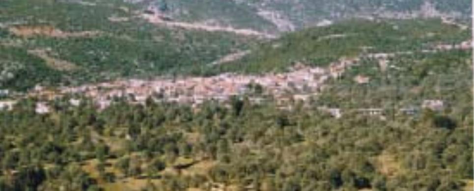
GERAKIOU (Village) ISTIEA
It is a village on a slope of a mountain situated only 4 km away from
Pefki in a thick forest of plane
and pine trees. Creeks pouring down in a waterfall at the entrance of the village
complete the scenery. The village was given its name due to the numerous nests
of falcons (the Greek word for falcon is "geraki") in the area. The people are
mainly engaged in the exploitation of forestal resources.
Τhis text is cited May 2003 from the Municipality
of Artemissio tourist pamphlet.
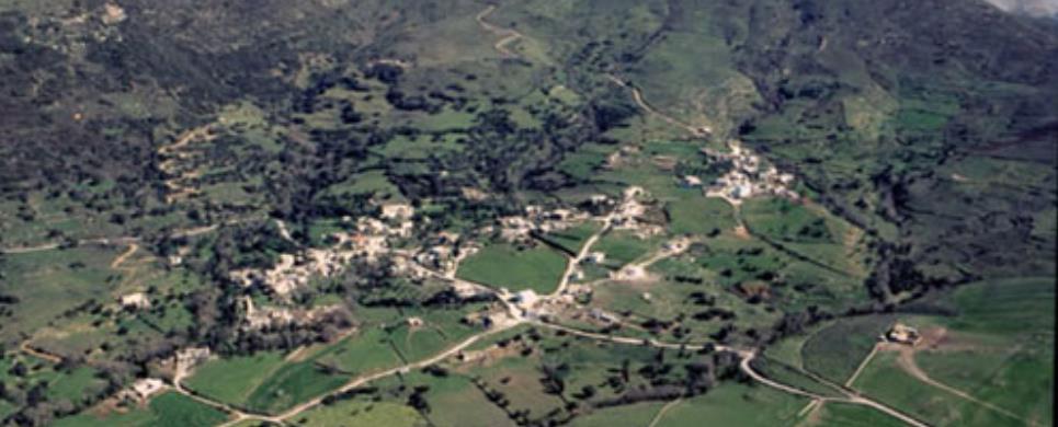
GOUVES (Village) EVIA
Tel: +30 22260 41435
A traditional village built on two mountain slopes full of plane and
pine trees. During the Turkish domination the region belonged to the Turkish bey
Mohamed Ibrahim and his sister Haime Naile. In 1831 the Turks sold their land
to the Greeks Vaptistis Drossos and Alexandros Desyllas. In 1882 the land of the
community was transferred to its inhabitants. The only highschool in the Municipality
of Artemissio is situated in the village.
A tower, where the Greek poet George Drossinis lived, rises above
the village. The tower has been restored to accommodate a museum. On the beach
of the village the fortress of Metaxas, which served as a defense post during
the World War II, still remains. You can see the base of the cannons, the cook-house
and the watch tower.
Τhis text is cited May 2003 from the Municipality
of Artemissio tourist pamphlet.
KALIMERIANI (Village) KYMI
Tel: +30 22220 23222
Fax: +30 22220 23222
KALOCHORI-PANTICHI (Village) AVLIDA
Tel: +30 22210 32945
KARYSTOS (Town) EVIA
The capital of southern Evia, Karystos, is built on the southern part of the island on a cove and in the shadow of mount Ochi. It is a modern town, developed for tourism. Karystos is approximately 120 km southeast from Chalkida but with a ferry connection to the eastern coasts of Attica.
The area has wonderful beaches and picturesque villages on mount Ochi, combining both sea and mountain. It can be the base for enticing tours to beaches or the mountain villages of Cavo D’Oro, in the Dimosari canyon.
The text was published on May 2003 in a brochure of Regional Division of Evia.
KASTANIOTISSA (Village) ISTIEA

KATO KOUROUNI (Village) KARYSTIA
Tel: +30 22220 58040
KECHRIES (Village) CHALKIDA
Tel: +30 22270 92400
Kechries could be characterized as a junction connecting the eastern
with the western coasts of Evia, establishing, thus, ideal conditions for anyone
who wishes to spend his vacations there, combining the green forests of the village
with the freedom of choice among the coasts of Aegean or Evoic Seas.
Traditions and legends have combined the history of the small fountain,
found in the situation where the medieval village, so called Ligdia, and the passing
from there of the legendary knight, Erotocritos.
The area, which during the times of Turkish occupation was a Kara-Ali's
estate, was assigned, after the liberation, to the hands of the resolution fighter,
Angelos Tombazis. Then, after a decision of the Greek Government in 1925 it was
assigned to the landless farmers of the area.
Similar but at the same time, parallel to the history of Kechries,
is also the history of Daphne co-existing with the village of Kechries. It should
be noticed that in old times Daphne
was called "Mantanika" originated from the word "mantani" probably meaning the
high production.
This text is cited May 2003 from the Municipality
of Elymnies tourist pamphlet.
KONTODESPOTI (Village) CHALKIDA
Tel: +30 22280 91271
KOURKOULI (Village) CHALKIDA
Tel: +30 22270 92066
The village, so called Kourkouli, is a traditional mountainous colony.
It is situated at the 3rd km over the axis of the central road of Chalkida-Limni
and the foot of the mountain, so called "Dry
Mountain", in beautiful fully green with pine trees areas, on inclined plane
and altimeter of 400 meters.
It is of panoramic views, when one looks at the horizon of Aegean
Sea but also Evoic Bay.
The village was built by the residents of the colony, so called Skoulari,
which was situated at a distance of about 2 kilometers from the today's village
to the area of Drymona. Its residents
were forced to move because of brigands' and corsairs' invasions. The residents,
first, gave the village the name "Neo Skoulari". The Turks, however, changed its
name to "Kourkouli" meaning "pursued people". So, this name prevailed and has
been kept even until today.
This text is cited May 2003 from the Municipality
of Elymnies tourist pamphlet.
LIMNI (Small town) EVIA
Elymnion of the ancient people and Evoic Aeges. A coastal nice small
town with traditional elements in a soft creek of northern Evoic Bay, being situated
between Chalkida and Edipsos.
Looking back to mythology we find it in the prehistoric times at the
moment when Jupiter first joined Juno and during the historic times it became
a place of the gods' worship.
During the years of colonization it established its own colonies,
such as Kleones (and perhaps Elymnio) in the Chalkidiki
peninsula of Mount Athos.
In Roman, Byzantin and Francovenetian times its navigation flourished
again and it was attacked by various conquerors.
In the mid of the 16th century, immigrants from Aegean Sea arrive
in Elymnio, as in the same years, in a miraculous way, the ancient icon of The
Blessed Virgin Mary the "Lymnian" also arrives here, which came to become the
religious palladium of this place.
With the coincidence of both these events Castral Elymnio moves down
to the shore erecting there the today's town of Limni.
During the years of National Regeneration, it plays the leading part,
starting the Evoic Revolution.
In the years of liberation it forms a considerable commercial navy contributing to the whole case of the Greek Navigation.
In the years of the 2nd World War Occupation it plays again a leading
part, bringing forth famous figures of our Panhellenic National Resistance.
Today, it is a touristically developed town with signs of insular
traditional structure, with historical places and convents, rich folkloric tradition,
multiple natural beauty and summer cool winds, uninterruptedly caressing the tiled
roofs and...whistling its old tales...
This text is cited May 2003 from the Municipality
of Elymnies tourist pamphlet.
MAKRYCHORI (Village) KARYSTIA
Tel: +30 22220 81280
MESSOCHORIA (Village) KARYSTIA
Tel: +30 22240 53274
Messochoria, of the Municipality of Styra, took their name from one
of the villages. These villages, aside from Messochori
itself, are Riza, Souristra, the Charitides and Korfiotes, which is located on
the height. Along with the hamlets of Raptei
and Tsakei they have a population
of around 600.
The villages are located around 3.5 km from the Aegen
Sea and have two exits onto the discharges of the small dry streams, where
there are the bays of Almyriki (or Armyrorychi) and Limnionas. During the German
occupation, Greek and British members of the resistance escaped to the Middle
East from these bays and that at Tsakei. The bay of Limniona with its clean sand
has today developed into a summer resort.
There is a stone fountain with a vaulted arch at Kamara. This village
was known as Paleochori in Byzantine times. The hermitages of St. Dimitrios, St.
Nicholas and St. George, with a vaulted arch in the sanctuary, are still standing.
In the ravine there are the remains of a watermill which was built in 1890. A
trip to the ruins of the Monastery of the Evangelism of Tsakei, which today still
functions as a monastery due to the presence of one nun, is worth a visit.
This text is cited May 2003 from the Municipality
of Styra tourist pamphlet.
NEA LAMPSAKOS (Small town) CHALKIDA
Tel: +30 22210 22215
NEA STYRA (Port) EVIA
Nea Styra has today evolved into a summer resort with great prospects
for further development. It was once however nothing more than the seaport of
Styra and a beautiful coast.
The first settlement with the name of Gkisouri, was built in 1895. It took the
name of Nea Styra in 1940.
Today, Nea Styra is served by one of the ferry lines which connect
southern Evia with shores of eastern Attica. There are also regular car ferries
to and from Agia Marina on
the opposite coast.
This text is cited May 2003 from the Municipality
of Styra tourist pamphlet.
NEOS PYRGOS (Small town) ISTIEA
The area was first inhabited during the Neolithic Era, according to findings in Kastri, near Oreos.
The beautiful seaside town that we see today was created by the refugees, that arrived here in 1926, from Pyrgos in Constantinople, who turned the place into a small paradise.
Ever since it was formed, the municipality of Pyrgos is constantly developing. It is near the Istiea – Edipsos road, 7km from Istiea, and along a beautiful sandy beach. Today, Pyrgos is almost one with the town of Orei as new homes are being built.
West of Pyrgos (approximately 1km) is a small natural beach near the old Istiea – Edipsos road. This area is called ‘Nissiotisa’.
Contemporary Pyrgos has approximately 1500 permanent residents, many hotels of a variety of categories as well as small homes and apartments for rent.
The above extract is from the tourist brochure of the municipality of Orei , May 2003.
NEROTRIVIA (Village) CHALKIDA
Tel: +30 22280 31469
OREI (Village) EVIA
The town of Orei and its coastline was planned and built in 1833 by the Bavarian topographer, George Sdoumayer. This explains the fact that the area close to the port was not residential because of the fear of invasions from the sea. The building in this area started after 1850 with plans from Bavarian palace builders and Stamatis Kleanthis, a Greek engineer from Constantinople.
In August 1965 a 3.2m long marble bull, from the Hellenistic era was found at the beach and is now exhibited behind the church of Sotiros at the port.
Inside the municipal building one can also see the findings of the archaeological collection of Orei, Istiea and the surrounding areas.
Nowadays, from May to October, both locals and tourists, for their evening outings, prefer the port of Orei. At the port one can also see many sail boats as armature races also take place during the summer.
The above extract is from the tourist brochure of the municipality of Orei , May 2003.

Receive our daily Newsletter with all the latest updates on the Greek Travel industry.
Subscribe now!